
Thank you for supporting this site ❤️
Make a donation
Make a donation
Schwanewede topographic map
Click on the map to display elevation.
Thank you for supporting this site ❤️
Make a donation
Make a donation
About this map
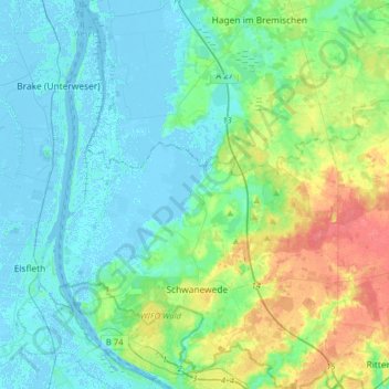
Name: Schwanewede topographic map, elevation, terrain.
Location: Schwanewede, Landkreis Osterholz, Lower Saxony, 28790, Germany (53.17645 8.48071 53.36701 8.70299)
Average elevation: 13 m
Minimum elevation: -4 m
Maximum elevation: 51 m
Thank you for supporting this site ❤️
Make a donation
Make a donation