
Thank you for supporting this site ❤️
Make a donation
Make a donation
Nottuln topographic map
Click on the map to display elevation.
Thank you for supporting this site ❤️
Make a donation
Make a donation
About this map
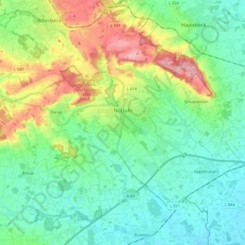
Name: Nottuln topographic map, elevation, terrain.
Location: Nottuln, Kreis Coesfeld, North Rhine-Westphalia, 48301, Germany (51.87692 7.25410 51.97061 7.46244)
Average elevation: 99 m
Minimum elevation: 60 m
Maximum elevation: 192 m
Thank you for supporting this site ❤️
Make a donation
Make a donation