
Thank you for supporting this site ❤️
Make a donation
Make a donation
Chiang Mai City Municipality topographic map
Click on the map to display elevation.
Thank you for supporting this site ❤️
Make a donation
Make a donation
Chiang Mai City Municipality
The city is situated in a valley on a river basin in the Thai highlands and is on average at 300 m (1,000 ft) elevation. Chiang Mai's city centre sits west of the Ping River, a tributary to the Chao Phraya River, while the city's sprawl extends north-west, south-west, north-east and east of the river. To the west side of Chiang Mai lies the Thanon Thong Chai Mountain Range, with one major peak, Doi Suthep mountain, prominently rising above the city with an elevation of 1,676 metres (5,499 ft).
Thank you for supporting this site ❤️
Make a donation
Make a donation
About this map
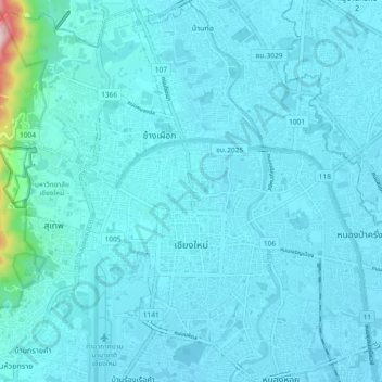
Name: Chiang Mai City Municipality topographic map, elevation, terrain.
Average elevation: 325 m
Minimum elevation: 300 m
Maximum elevation: 668 m
Thank you for supporting this site ❤️
Make a donation
Make a donation
Other topographic maps
Click on a map to view its topography, its elevation and its terrain.