
Ciudadela topographic map
Interactive map
Click on the map to display elevation.
About this map
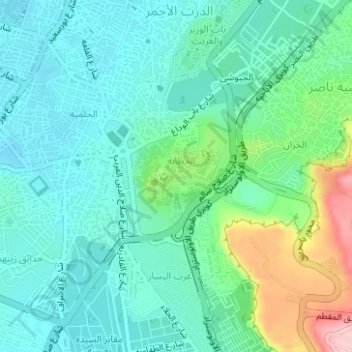
Name: Ciudadela topographic map, elevation, terrain.
Average elevation: 65 m
Minimum elevation: 20 m
Maximum elevation: 206 m
Other topographic maps
Click on a map to view its topography, its elevation and its terrain.
ميدان عبد المنعم رياض
Egipto > El Cairo > El Cairo > ميدان عبد المنعم رياض
ميدان عبد المنعم رياض, El Cairo, 12344, Egipto
Average elevation: 27 m