
Thank you for supporting this site ❤️
Make a donation
Make a donation
Galatea topographic map
Click on the map to display elevation.
Thank you for supporting this site ❤️
Make a donation
Make a donation
About this map
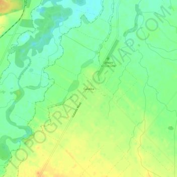
Name: Galatea topographic map, elevation, terrain.
Location: Galatea, Whakatāne District, Bay of Plenty, New Zealand (-38.43084 176.71854 -38.39084 176.75854)
Average elevation: 174 m
Minimum elevation: 157 m
Maximum elevation: 195 m
Whakatane District trails, hiking, mountain biking, running and outdoor activities
Thank you for supporting this site ❤️
Make a donation
Make a donation
Other topographic maps
Click on a map to view its topography, its elevation and its terrain.