
Sanford topographic map
Interactive map
Click on the map to display elevation.
About this map
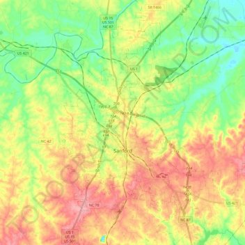
Name: Sanford topographic map, elevation, terrain.
Location: Sanford, Lee County, North Carolina, United States (35.40707 -79.24151 35.59538 -79.09240)
Average elevation: 99 m
Minimum elevation: 49 m
Maximum elevation: 157 m
Other topographic maps
Click on a map to view its topography, its elevation and its terrain.