
Salh District topographic map
Interactive map
Click on the map to display elevation.
About this map
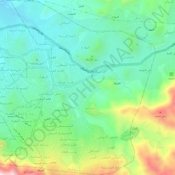
Name: Salh District topographic map, elevation, terrain.
Location: Salh District, Ta'izz Governorate, Yemen (13.55767 44.01620 13.61003 44.06119)
Average elevation: 1,371 m
Minimum elevation: 1,167 m
Maximum elevation: 1,865 m