
Plitvice Lakes National Park topographic map
Interactive map
Click on the map to display elevation.
Plitvice Lakes National Park
The 16 lakes are separated into an upper and lower cluster formed by runoff from the mountains, descending from an altitude of 636 to 503 m (2,087 to 1,650 ft) over a distance of some 8 kilometres (5.0 mi), aligned in a south–north direction. The lakes collectively cover an area of about 0.77 square miles, the water exiting from the lowest lake forming the Korana River.
About this map
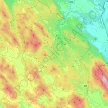
Name: Plitvice Lakes National Park topographic map, elevation, terrain.
Average elevation: 765 m
Minimum elevation: 284 m
Maximum elevation: 1,637 m