
GSIS topographic map
Click on the map to display elevation.
About this map
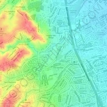
Name: GSIS topographic map, elevation, terrain.
Location: GSIS, San Pedro, Laguna, Calabarzon, 4023, Philippines (14.34104 121.02963 14.35371 121.04278)
Average elevation: 37 m
Minimum elevation: 9 m
Maximum elevation: 83 m