
Manawahe topographic map
Click on the map to display elevation.
About this map
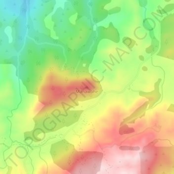
Name: Manawahe topographic map, elevation, terrain.
Location: Manawahe, Whakatane District, Bay of Plenty, New Zealand (-37.96230 176.67113 -37.96220 176.67123)
Average elevation: 332 m
Minimum elevation: 186 m
Maximum elevation: 488 m
Whakatane District trails, hiking, mountain biking, running and outdoor activities
Other topographic maps
Click on a map to view its topography, its elevation and its terrain.