
Thank you for supporting this site ❤️
Make a donation
Make a donation
Volgograd topographic map
Click on the map to display elevation.
Thank you for supporting this site ❤️
Make a donation
Make a donation
About this map
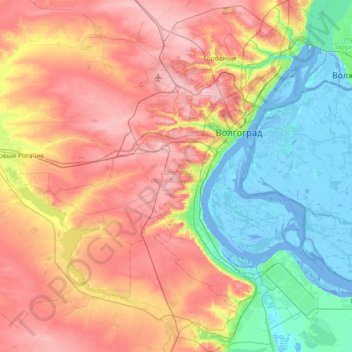
Name: Volgograd topographic map, elevation, terrain.
Location: Volgograd, Volgograd Oblast, Russia (48.40705 44.10877 48.88907 44.68743)
Average elevation: 71 m
Minimum elevation: -15 m
Maximum elevation: 163 m
Thank you for supporting this site ❤️
Make a donation
Make a donation