
Thank you for supporting this site ❤️
Make a donation
Make a donation
Cunard topographic map
Click on the map to display elevation.
Thank you for supporting this site ❤️
Make a donation
Make a donation
About this map
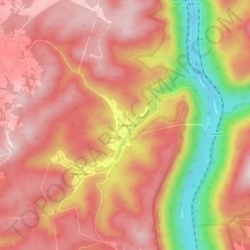
Name: Cunard topographic map, elevation, terrain.
Location: Cunard, Fayette County, West Virginia, United States (37.97872 -81.05954 38.01872 -81.01954)
Average elevation: 534 m
Minimum elevation: 282 m
Maximum elevation: 665 m
Thank you for supporting this site ❤️
Make a donation
Make a donation
Other topographic maps
Click on a map to view its topography, its elevation and its terrain.