
Thank you for supporting this site ❤️
Make a donation
Make a donation
Tetu topographic map
Click on the map to display elevation.
Thank you for supporting this site ❤️
Make a donation
Make a donation
About this map
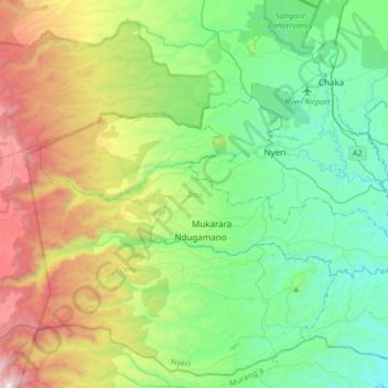
Name: Tetu topographic map, elevation, terrain.
Location: Tetu, Nyeri, Central Kenya, Kenya (-0.52663 36.75081 -0.38513 37.08312)
Average elevation: 2,139 m
Minimum elevation: 1,542 m
Maximum elevation: 3,547 m
Thank you for supporting this site ❤️
Make a donation
Make a donation