
Thank you for supporting this site ❤️
Make a donation
Make a donation
Waukomis topographic map
Click on the map to display elevation.
Thank you for supporting this site ❤️
Make a donation
Make a donation
About this map
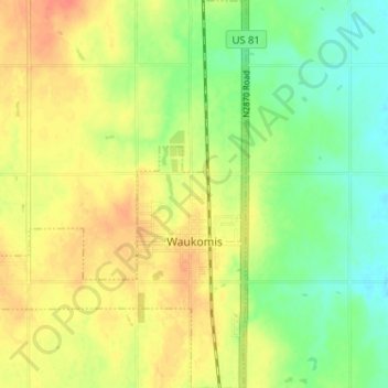
Name: Waukomis topographic map, elevation, terrain.
Location: Waukomis, Garfield County, Oklahoma, 73773, United States (36.26070 -97.94345 36.31253 -97.88952)
Average elevation: 372 m
Minimum elevation: 349 m
Maximum elevation: 394 m
Thank you for supporting this site ❤️
Make a donation
Make a donation
Other topographic maps
Click on a map to view its topography, its elevation and its terrain.