
Thank you for supporting this site ❤️
Make a donation
Make a donation
Nyhem topographic map
Click on the map to display elevation.
Thank you for supporting this site ❤️
Make a donation
Make a donation
About this map
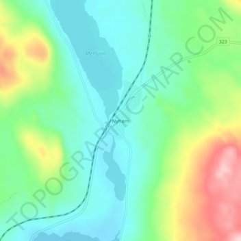
Name: Nyhem topographic map, elevation, terrain.
Location: Nyhem, Bräcke kommun, Jämtland County, Sweden (62.87078 15.59553 62.91078 15.63553)
Average elevation: 325 m
Minimum elevation: 262 m
Maximum elevation: 487 m
Thank you for supporting this site ❤️
Make a donation
Make a donation