
Santo Tomás topographic map
Interactive map
Click on the map to display elevation.
About this map
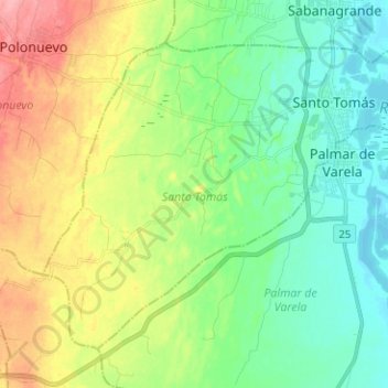
Name: Santo Tomás topographic map, elevation, terrain.
Location: Santo Tomás, Atlántico, Colombia (10.68145 -74.85090 10.77974 -74.72527)
Average elevation: 36 m
Minimum elevation: 2 m
Maximum elevation: 98 m