
Thank you for supporting this site ❤️
Make a donation
Make a donation
Woja topographic map
Click on the map to display elevation.
Thank you for supporting this site ❤️
Make a donation
Make a donation
About this map
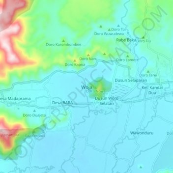
Name: Woja topographic map, elevation, terrain.
Location: Woja, Dompu, West Nusa Tenggara, 84251, Indonesia (-8.58098 118.36473 -8.50098 118.44473)
Average elevation: 82 m
Minimum elevation: 2 m
Maximum elevation: 489 m
Thank you for supporting this site ❤️
Make a donation
Make a donation