
Thank you for supporting this site ❤️
Make a donation
Make a donation
Whau River topographic map
Click on the map to display elevation.
Thank you for supporting this site ❤️
Make a donation
Make a donation
About this map
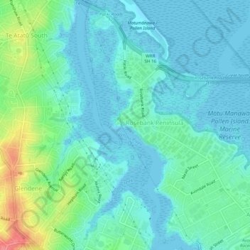
Name: Whau River topographic map, elevation, terrain.
Location: Whau River, Whau, Auckland, 0600, New Zealand (-36.89862 174.65757 -36.85945 174.67857)
Average elevation: 17 m
Minimum elevation: 0 m
Maximum elevation: 77 m
Auckland trails, hiking, mountain biking, running and outdoor activities
Thank you for supporting this site ❤️
Make a donation
Make a donation