
Thank you for supporting this site ❤️
Make a donation
Make a donation
Tong topographic map
Click on the map to display elevation.
Thank you for supporting this site ❤️
Make a donation
Make a donation
About this map
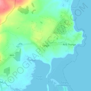
Name: Tong topographic map, elevation, terrain.
Location: Tong, Western Isles, Scotland, HS2 0HJ, United Kingdom (58.22373 -6.36947 58.26373 -6.32947)
Average elevation: 15 m
Minimum elevation: -3 m
Maximum elevation: 80 m
Thank you for supporting this site ❤️
Make a donation
Make a donation