
Martinborough topographic map
Click on the map to display elevation.
About this map
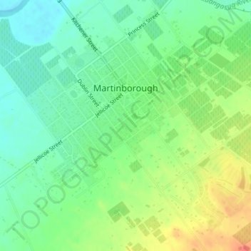
Name: Martinborough topographic map, elevation, terrain.
Average elevation: 34 m
Minimum elevation: 14 m
Maximum elevation: 65 m
South Wairarapa District trails, hiking, mountain biking, running and outdoor activities
Other topographic maps
Click on a map to view its topography, its elevation and its terrain.
Hinakura
New Zealand > Wellington > South Wairarapa District > Martinborough Community
Average elevation: 86 m
Ngāwī
New Zealand > Wellington > South Wairarapa District > Martinborough Community
Average elevation: 97 m
Waipawa
New Zealand > Wellington > South Wairarapa District > Martinborough Community
Average elevation: 165 m