
Thank you for supporting this site ❤️
Make a donation
Make a donation
Freestone County topographic map
Click on the map to display elevation.
Thank you for supporting this site ❤️
Make a donation
Make a donation
About this map
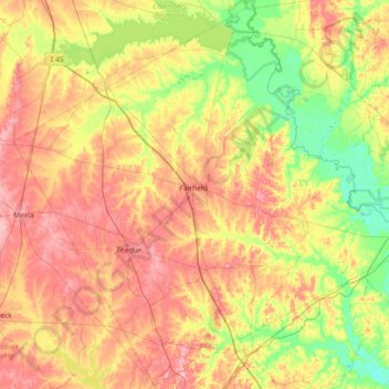
Name: Freestone County topographic map, elevation, terrain.
Location: Freestone County, Texas, United States (31.41341 -96.49677 32.01260 -95.77957)
Average elevation: 115 m
Minimum elevation: 60 m
Maximum elevation: 180 m
Thank you for supporting this site ❤️
Make a donation
Make a donation