
Fredrikstad topographic map
Interactive map
Click on the map to display elevation.
About this map
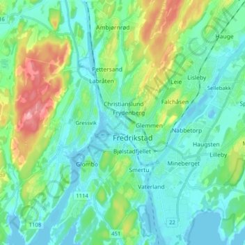
Name: Fredrikstad topographic map, elevation, terrain.
Location: Fredrikstad, Viken, 1607, Norway (59.05336 10.77616 59.37336 11.09616)
Average elevation: 24 m
Minimum elevation: -3 m
Maximum elevation: 187 m
Other topographic maps
Click on a map to view its topography, its elevation and its terrain.