
Thank you for supporting this site ❤️
Make a donation
Make a donation
Coeses topographic map
Click on the map to display elevation.
Thank you for supporting this site ❤️
Make a donation
Make a donation
About this map
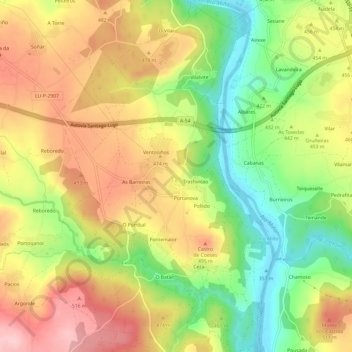
Name: Coeses topographic map, elevation, terrain.
Location: Coeses, Lugo, Galicia, 27181, España (42.92697 -7.55038 42.97114 -7.51350)
Average elevation: 447 m
Minimum elevation: 353 m
Maximum elevation: 537 m
Thank you for supporting this site ❤️
Make a donation
Make a donation
Other topographic maps
Click on a map to view its topography, its elevation and its terrain.