
Manchester topographic map
Click on the map to display elevation.
About this map
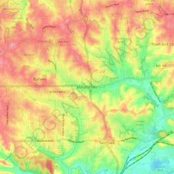
Name: Manchester topographic map, elevation, terrain.
Location: Manchester, Saint Louis County, Missouri, United States (38.55253 -90.55075 38.63253 -90.47075)
Average elevation: 173 m
Minimum elevation: 120 m
Maximum elevation: 214 m
Other topographic maps
Click on a map to view its topography, its elevation and its terrain.