
Xochitepec topographic map
Interactive map
Click on the map to display elevation.
About this map
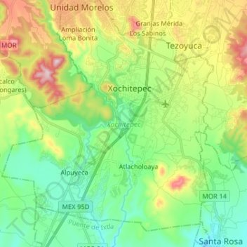
Name: Xochitepec topographic map, elevation, terrain.
Location: Xochitepec, Morelos, 62790, México (18.70404 -99.29797 18.82680 -99.18672)
Average elevation: 1,133 m
Minimum elevation: 972 m
Maximum elevation: 1,451 m
Other topographic maps
Click on a map to view its topography, its elevation and its terrain.