
Thank you for supporting this site ❤️
Make a donation
Make a donation
Elk Mills topographic map
Click on the map to display elevation.
Thank you for supporting this site ❤️
Make a donation
Make a donation
About this map
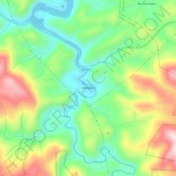
Name: Elk Mills topographic map, elevation, terrain.
Location: Elk Mills, Carter County, Tennessee, United States (36.25262 -82.00984 36.29262 -81.96984)
Average elevation: 749 m
Minimum elevation: 593 m
Maximum elevation: 996 m
Thank you for supporting this site ❤️
Make a donation
Make a donation
Other topographic maps
Click on a map to view its topography, its elevation and its terrain.