
Thank you for supporting this site ❤️
Make a donation
Make a donation
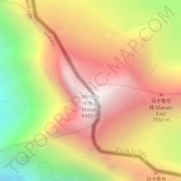
Mount Makalu topographic map
Click on the map to display elevation.
Thank you for supporting this site ❤️
Make a donation
Make a donation
Mount Makalu
Makalu (Nepali: मकालु हिमाल, romanized: Makālu himāl; Chinese: 马卡鲁峰; pinyin: Mǎkǎlǔ Fēng) is the fifth-highest mountain on Earth, with a summit at an elevation of 8,485 metres (27,838 ft) AMSL. It is located in the Mahalangur Himalayas 19 km (12 mi) southeast of Mount Everest, on the China–Nepal border. One of the eight-thousanders, Makalu is an isolated peak shaped like a four-sided pyramid.
Thank you for supporting this site ❤️
Make a donation
Make a donation
About this map
Name: Mount Makalu topographic map, elevation, terrain.
Average elevation: 7,479 m
Minimum elevation: 6,303 m
Maximum elevation: 8,389 m
Thank you for supporting this site ❤️
Make a donation
Make a donation