
Thank you for supporting this site ❤️
Make a donation
Make a donation
Pawnee topographic map
Click on the map to display elevation.
Thank you for supporting this site ❤️
Make a donation
Make a donation
About this map
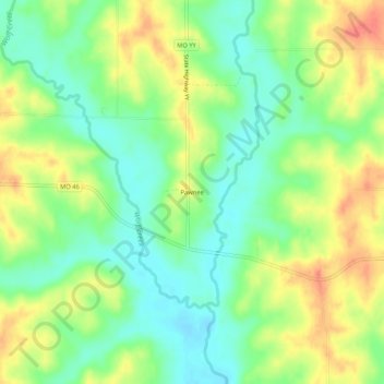
Name: Pawnee topographic map, elevation, terrain.
Location: Pawnee, Harrison County, Missouri, United States (40.50194 -94.07079 40.54194 -94.03079)
Average elevation: 317 m
Minimum elevation: 293 m
Maximum elevation: 346 m
Thank you for supporting this site ❤️
Make a donation
Make a donation
Other topographic maps
Click on a map to view its topography, its elevation and its terrain.