
Thank you for supporting this site ❤️
Make a donation
Make a donation
Stratford topographic map
Click on the map to display elevation.
Thank you for supporting this site ❤️
Make a donation
Make a donation
About this map
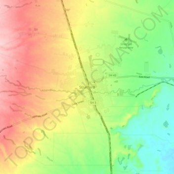
Name: Stratford topographic map, elevation, terrain.
Location: Stratford, Stratford District, Taranaki, 4332, New Zealand (-39.37969 174.24409 -39.29969 174.32409)
Average elevation: 310 m
Minimum elevation: 220 m
Maximum elevation: 410 m
Stratford District trails, hiking, mountain biking, running and outdoor activities
Thank you for supporting this site ❤️
Make a donation
Make a donation