
Thank you for supporting this site ❤️
Make a donation
Make a donation
Clive topographic map
Click on the map to display elevation.
Thank you for supporting this site ❤️
Make a donation
Make a donation
About this map
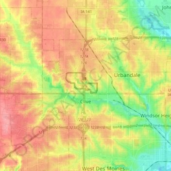
Name: Clive topographic map, elevation, terrain.
Location: Clive, Polk County, Iowa, 50325, United States (41.59642 -93.87186 41.64379 -93.71810)
Average elevation: 287 m
Minimum elevation: 242 m
Maximum elevation: 326 m
Thank you for supporting this site ❤️
Make a donation
Make a donation