
Thank you for supporting this site ❤️
Make a donation
Make a donation
Valle topographic map
Click on the map to display elevation.
Thank you for supporting this site ❤️
Make a donation
Make a donation
About this map
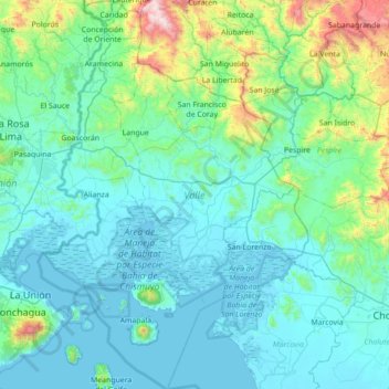
Name: Valle topographic map, elevation, terrain.
Location: Valle, Honduras (13.17070 -87.82950 13.85161 -87.34231)
Average elevation: 201 m
Minimum elevation: -1 m
Maximum elevation: 1,576 m
Thank you for supporting this site ❤️
Make a donation
Make a donation
Other topographic maps
Click on a map to view its topography, its elevation and its terrain.