
Thank you for supporting this site ❤️
Make a donation
Make a donation
Cayo Menor topographic map
Click on the map to display elevation.
Thank you for supporting this site ❤️
Make a donation
Make a donation
About this map
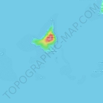
Name: Cayo Menor topographic map, elevation, terrain.
Location: Cayo Menor, Roatán, Bay Islands, Honduras (15.93304 -86.51896 15.97304 -86.47896)
Average elevation: 2 m
Minimum elevation: 0 m
Maximum elevation: 122 m
Thank you for supporting this site ❤️
Make a donation
Make a donation