
Darup topographic map
Interactive map
Click on the map to display elevation.
About this map
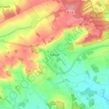
Name: Darup topographic map, elevation, terrain.
Location: Darup, Nottuln, Kreis Coesfeld, Nordrhein-Westfalen, Deutschland (51.90942 7.27681 51.94942 7.31681)
Average elevation: 123 m
Minimum elevation: 78 m
Maximum elevation: 173 m
Other topographic maps
Click on a map to view its topography, its elevation and its terrain.
Schapdetten
Deutschland > Nordrhein-Westfalen > Kreis Coesfeld > Nottuln
Schapdetten, Nottuln, Kreis Coesfeld, Nordrhein-Westfalen, 48329, Deutschland
Average elevation: 103 m
Appelhülsen
Deutschland > Nordrhein-Westfalen > Kreis Coesfeld > Nottuln
Appelhülsen, Nottuln, Kreis Coesfeld, Nordrhein-Westfalen, Deutschland
Average elevation: 70 m