Geolocate

Papamoa topographic map

Interactive map

Click on the map to display elevation.

About this map

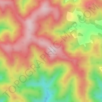
Name: Papamoa topographic map, elevation, terrain.

Location: Papamoa, Ōpōtiki District, Bay of Plenty, New Zealand (-38.13270 177.47603 -38.13260 177.47613)

Average elevation: 544 m

Minimum elevation: 246 m

Maximum elevation: 753 m

Other topographic maps

Click on a map to view its topography, its elevation and its terrain.

Parinui

New Zealand > Bay of Plenty > Ōpōtiki District

Parinui, Ōpōtiki District, Bay of Plenty, 3162, New Zealand

Average elevation: 67 m

Whitianga

New Zealand > Bay of Plenty > Ōpōtiki District

Whitianga, Ōpōtiki District, Bay of Plenty, 3162, New Zealand

Average elevation: 42 m

Opotiki

New Zealand > Bay of Plenty > Ōpōtiki District

Opotiki, Ōpōtiki District, Bay of Plenty, 3122, New Zealand

Average elevation: 14 m

Ohiwa

New Zealand > Bay of Plenty > Ōpōtiki District

Ohiwa, Ōpōtiki District, Bay of Plenty, 3198, New Zealand

Average elevation: 11 m

Kaharoa

New Zealand > Bay of Plenty > Ōpōtiki District

Kaharoa, Ōpōtiki District, Bay of Plenty, New Zealand

Average elevation: 721 m