
Days Bay topographic map
Click on the map to display elevation.
About this map
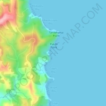
Name: Days Bay topographic map, elevation, terrain.
Location: Days Bay, Waiheke, Auckland, New Zealand (-36.81053 175.16524 -36.81043 175.16534)
Average elevation: 34 m
Minimum elevation: 0 m
Maximum elevation: 174 m
Auckland trails, hiking, mountain biking, running and outdoor activities