
Thank you for supporting this site ❤️
Make a donation
Make a donation
Pontevedra topographic map
Click on the map to display elevation.
Thank you for supporting this site ❤️
Make a donation
Make a donation
About this map
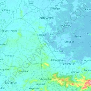
Name: Pontevedra topographic map, elevation, terrain.
Location: Pontevedra, Capiz, Western Visayas, Philippines (11.37493 122.79717 11.50792 122.92385)
Average elevation: 16 m
Minimum elevation: -3 m
Maximum elevation: 222 m
Thank you for supporting this site ❤️
Make a donation
Make a donation
Other topographic maps
Click on a map to view its topography, its elevation and its terrain.