
Thank you for supporting this site ❤️
Make a donation
Make a donation
Wood Heights topographic map
Click on the map to display elevation.
Thank you for supporting this site ❤️
Make a donation
Make a donation
About this map
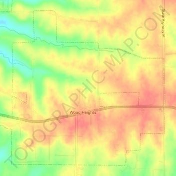
Name: Wood Heights topographic map, elevation, terrain.
Location: Wood Heights, Ray County, Missouri, United States (39.33059 -94.18306 39.35643 -94.14518)
Average elevation: 313 m
Minimum elevation: 277 m
Maximum elevation: 332 m
Thank you for supporting this site ❤️
Make a donation
Make a donation
Other topographic maps
Click on a map to view its topography, its elevation and its terrain.