
Thank you for supporting this site ❤️
Make a donation
Make a donation
Oyodo topographic map
Click on the map to display elevation.
Thank you for supporting this site ❤️
Make a donation
Make a donation
About this map
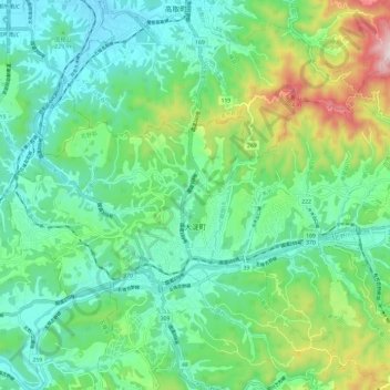
Name: Oyodo topographic map, elevation, terrain.
Location: Oyodo, Yoshino County, Nara Prefecture, Japan (34.37707 135.73952 34.42897 135.85840)
Average elevation: 239 m
Minimum elevation: 81 m
Maximum elevation: 674 m
Thank you for supporting this site ❤️
Make a donation
Make a donation