
Thank you for supporting this site ❤️
Make a donation
Make a donation
Turin topographic map
Click on the map to display elevation.
Thank you for supporting this site ❤️
Make a donation
Make a donation
About this map
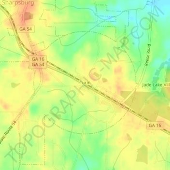
Name: Turin topographic map, elevation, terrain.
Location: Turin, Coweta County, Georgia, 30289, United States (33.31341 -84.64875 33.33886 -84.62550)
Average elevation: 273 m
Minimum elevation: 249 m
Maximum elevation: 288 m
Thank you for supporting this site ❤️
Make a donation
Make a donation
Other topographic maps
Click on a map to view its topography, its elevation and its terrain.