
Thank you for supporting this site ❤️
Make a donation
Make a donation
Magenta topographic map
Click on the map to display elevation.
Thank you for supporting this site ❤️
Make a donation
Make a donation
About this map
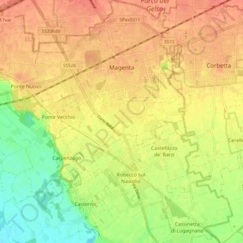
Name: Magenta topographic map, elevation, terrain.
Location: Magenta, Milan, Lombardy, 20013, Italy (45.41942 8.81706 45.48298 8.90734)
Average elevation: 132 m
Minimum elevation: 104 m
Maximum elevation: 149 m
Thank you for supporting this site ❤️
Make a donation
Make a donation
Other topographic maps
Click on a map to view its topography, its elevation and its terrain.