
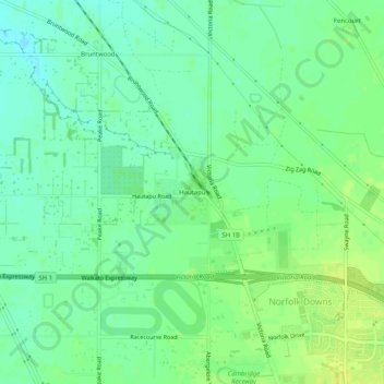
Hautapu topographic map
Interactive map
Click on the map to display elevation.
About this map
Name: Hautapu topographic map, elevation, terrain.
Location: Hautapu, Waipa District, Waikato, 3493, New Zealand (-37.87976 175.43130 -37.83976 175.47130)
Average elevation: 67 m
Minimum elevation: 58 m
Maximum elevation: 78 m
Other topographic maps
Click on a map to view its topography, its elevation and its terrain.
Moanatuatua Swamp
New Zealand > Waikato > Waipa District
Moanatuatua Swamp, Waipa District, Waikato, New Zealand
Average elevation: 66 m
Rangiaowhia War Memorial Domain
New Zealand > Waikato > Waipa District > Kihikihi > Rangiaowhia
Rangiaowhia War Memorial Domain, Rangiaowhia, Kihikihi, Waipa District, Waikato, New Zealand
Average elevation: 69 m
Kairangi Hill
New Zealand > Waikato > Waipa District
Kairangi Hill, Waipa District, Waikato, New Zealand
Average elevation: 156 m
Te Awamutu
New Zealand > Waikato > Waipa District
Te Awamutu, Waipa District, Waikato, 3800, New Zealand
Average elevation: 57 m
Mystery Creek
New Zealand > Waikato > Waipa District
Mystery Creek, Waipa District, Waikato, 3282, New Zealand
Average elevation: 52 m
Te Miro
New Zealand > Waikato > Waipa District
Te Miro, Waipa District, Waikato, 3496, New Zealand
Average elevation: 251 m
Maungatautari
New Zealand > Waikato > Waipa District
Maungatautari, Waipa District, Waikato, New Zealand
Average elevation: 121 m
Bruntwood
New Zealand > Waikato > Waipa District
Bruntwood, Waipa District, Waikato, 3493, New Zealand
Average elevation: 64 m
Kaipaki
New Zealand > Waikato > Waipa District > Kaipaki
Kaipaki, Waipa District, Waikato, 3283, New Zealand
Average elevation: 57 m
Ōhaupō
New Zealand > Waikato > Waipa District
Ōhaupō, Waipa District, Waikato, New Zealand
Average elevation: 56 m
Cambridge
New Zealand > Waikato > Waipa District
Cambridge, Waipa District, Waikato, 3434, New Zealand
Average elevation: 71 m
Lake Karapiro
New Zealand > Waikato > Waipa District > Karapiro
Lake Karapiro, Karapiro, Waipa District, Waikato, New Zealand
Average elevation: 174 m
Kihikihi
New Zealand > Waikato > Waipa District
Kihikihi, Waipa District, Waikato, 3800, New Zealand
Average elevation: 57 m
Whitehall
New Zealand > Waikato > Waipa District
Whitehall, Waipa District, Waikato, New Zealand
Average elevation: 157 m