
Stavanger topographic map
Interactive map
Click on the map to display elevation.
About this map
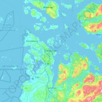
Name: Stavanger topographic map, elevation, terrain.
Location: Stavanger, Rogaland, 4006, Noruega (58.80995 5.57181 59.12995 5.89181)
Average elevation: 44 m
Minimum elevation: -1 m
Maximum elevation: 552 m
Other topographic maps
Click on a map to view its topography, its elevation and its terrain.