
Yulha-dong topographic map
Interactive map
Click on the map to display elevation.
About this map
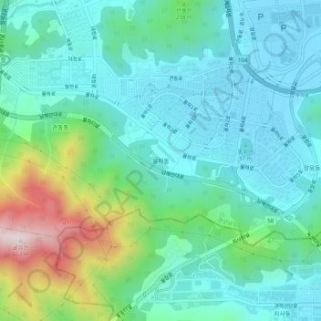
Name: Yulha-dong topographic map, elevation, terrain.
Location: Yulha-dong, Gimhae-si, Gyeongsangnam-do, 51019, South Korea (35.14696 128.78978 35.18696 128.82978)
Average elevation: 144 m
Minimum elevation: -1 m
Maximum elevation: 627 m