
Richat-Struktur topographic map
Interactive map
Click on the map to display elevation.
About this map
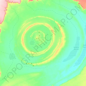
Name: Richat-Struktur topographic map, elevation, terrain.
Location: Richat-Struktur, Adrar, Mauretanien (20.95626 -11.56260 21.25345 -11.20524)
Average elevation: 402 m
Minimum elevation: 349 m
Maximum elevation: 605 m
Other topographic maps
Click on a map to view its topography, its elevation and its terrain.