
Thank you for supporting this site ❤️
Make a donation
Make a donation
Longhua County topographic map
Click on the map to display elevation.
Thank you for supporting this site ❤️
Make a donation
Make a donation
About this map
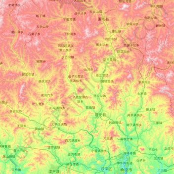
Name: Longhua County topographic map, elevation, terrain.
Location: Longhua County, Chengde City, Hebei, China (41.14382 116.79220 41.83607 118.30934)
Average elevation: 919 m
Minimum elevation: 313 m
Maximum elevation: 1,806 m
Thank you for supporting this site ❤️
Make a donation
Make a donation