
Thank you for supporting this site ❤️
Make a donation
Make a donation
Sandy Point topographic map
Click on the map to display elevation.
Thank you for supporting this site ❤️
Make a donation
Make a donation
About this map
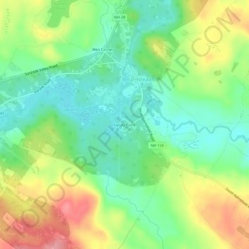
Name: Sandy Point topographic map, elevation, terrain.
Average elevation: 186 m
Minimum elevation: 142 m
Maximum elevation: 254 m
Thank you for supporting this site ❤️
Make a donation
Make a donation
Other topographic maps
Click on a map to view its topography, its elevation and its terrain.
Halfmoon Lake
United States > New Hampshire > Belknap County > Barnstead > Fernhill
Average elevation: 213 m