
Thank you for supporting this site ❤️
Make a donation
Make a donation
Gunung Angsana topographic map
Click on the map to display elevation.
Thank you for supporting this site ❤️
Make a donation
Make a donation
About this map
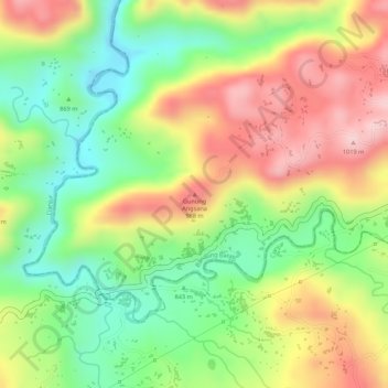
Name: Gunung Angsana topographic map, elevation, terrain.
Location: Gunung Angsana, West Bandung, Java, Indonesia (-7.05309 107.19384 -7.05299 107.19394)
Average elevation: 873 m
Minimum elevation: 759 m
Maximum elevation: 990 m
Thank you for supporting this site ❤️
Make a donation
Make a donation
Other topographic maps
Click on a map to view its topography, its elevation and its terrain.
RW 15 KEL. CIHANJUANG RAHAYU KEC. PAROMPONG KAB. BANDUNG BARAT
Indonesia > West Bandung > Cisarua > Villa Istana Bunga
Average elevation: 1,377 m