
Thank you for supporting this site ❤️
Make a donation
Make a donation
Whitefield topographic map
Click on the map to display elevation.
Thank you for supporting this site ❤️
Make a donation
Make a donation
About this map
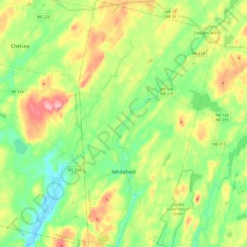
Name: Whitefield topographic map, elevation, terrain.
Location: Whitefield, Lincoln County, Maine, 04353, United States (44.12173 -69.66544 44.27963 -69.54028)
Average elevation: 60 m
Minimum elevation: -3 m
Maximum elevation: 162 m
Thank you for supporting this site ❤️
Make a donation
Make a donation
Other topographic maps
Click on a map to view its topography, its elevation and its terrain.