
Thank you for supporting this site ❤️
Make a donation
Make a donation
Likuyani topographic map
Click on the map to display elevation.
Thank you for supporting this site ❤️
Make a donation
Make a donation
About this map
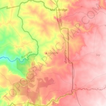
Name: Likuyani topographic map, elevation, terrain.
Location: Likuyani, Kakamega County, Western, Kenya (0.62847 35.01410 0.90044 35.15589)
Average elevation: 1,869 m
Minimum elevation: 1,634 m
Maximum elevation: 2,034 m
Thank you for supporting this site ❤️
Make a donation
Make a donation