
Thank you for supporting this site ❤️
Make a donation
Make a donation
Maheno topographic map
Click on the map to display elevation.
Thank you for supporting this site ❤️
Make a donation
Make a donation
About this map
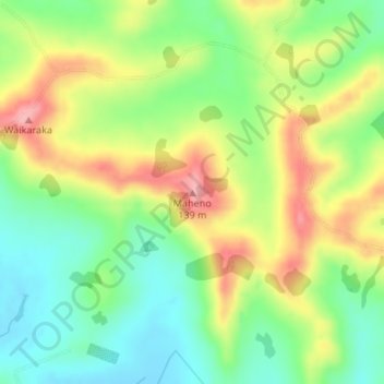
Name: Maheno topographic map, elevation, terrain.
Location: Maheno, Kaipara District, Northland, New Zealand (-36.06992 174.07126 -36.06982 174.07136)
Average elevation: 64 m
Minimum elevation: 9 m
Maximum elevation: 136 m
Kaipara District trails, hiking, mountain biking, running and outdoor activities
Thank you for supporting this site ❤️
Make a donation
Make a donation
Other topographic maps
Click on a map to view its topography, its elevation and its terrain.